0%

Geology - Ireland

The geology of the island of Ireland is a fascinating tapestry that spans over 600 million years of Earth’s history, encompassing a diverse range of rock types, geological structures, and landscapes. From ancient Precambrian bedrock to glaciated valleys carved during the Ice Age, Ireland’s geological heritage reflects a complex interplay of tectonic activity, erosion, and environmental change.

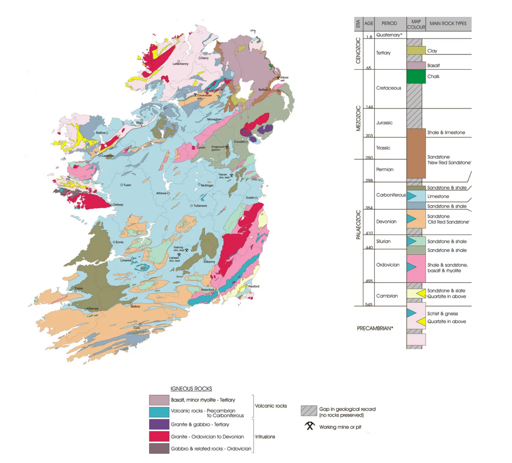
The geological foundation of Ireland is primarily composed of three major rock types: igneous, sedimentary, and metamorphic. These rocks provide insights into the island’s ancient history and environmental evolution.

Ireland Geology GIS

The oldest rocks in Ireland, dating back over 600 million years, are found in the northwest of the island, particularly in counties Donegal and Mayo. These rocks, known as the Dalradian Supergroup, consist of metamorphic rocks such as schist, gneiss, and quartzite, formed during intense tectonic activity and mountain-building events.

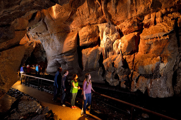
Much of Ireland’s surface is covered by sedimentary rocks, which were deposited over millions of years in ancient seas, lakes, and river deltas. These rocks include limestone, sandstone, shale, and mudstone, which vary in age from the Cambrian period to the Carboniferous period. The limestone landscapes of the Burren in County Clare and the karst region of the northwest are notable examples of Ireland’s sedimentary geology.

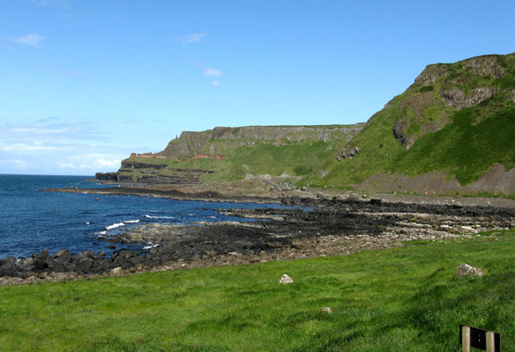
During the Carboniferous period, Ireland experienced volcanic activity, leading to the formation of basalt lava flows and volcanic ash deposits. These volcanic rocks are particularly prominent in the Antrim Plateau in Northern Ireland, where the Giant’s Causeway, a UNESCO World Heritage Site, showcases impressive columnar basalt formations.

The geological evolution of Ireland has been shaped by tectonic processes, including continental collisions, rifting, and faulting. The island’s tectonic history is primarily influenced by the interactions between the Eurasian Plate and the North American Plate.

During the Silurian and Devonian periods, Ireland was part of a landmass known as Laurentia, which collided with the ancient continent of Avalonia during the Caledonian orogeny. This collision led to the formation of mountain ranges and the uplift of the Caledonian Mountains, contributing to the formation of the Precambrian rocks in the northwest.

In the Carboniferous period, Ireland was situated near the equator and experienced tectonic activity associated with the Variscan orogeny. This event resulted in the closure of an ancient ocean known as the Rheic Ocean and the collision of Laurentia with the continent of Gondwana, leading to the formation of the supercontinent Pangaea. The Variscan orogeny produced the volcanic rocks of the Antrim Plateau and contributed to the folding and faulting of sedimentary rocks across Ireland.

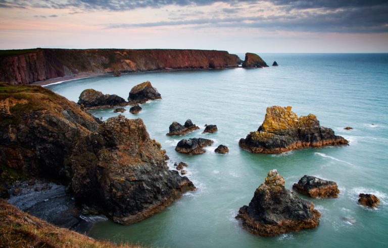
Subsequent tectonic activity, including extensional tectonics and rifting, led to the opening of the Atlantic Ocean and the separation of Ireland from mainland Europe. This process created the distinctive geological features of the Irish coastline, including sea cliffs, coastal stacks, and sandy beaches.

During the Pleistocene epoch, Ireland experienced multiple glaciations that profoundly shaped its landscape and geological features. Glacial erosion and deposition sculpted valleys, fjords, and drumlins, leaving behind a legacy of Quaternary landforms.

The last glaciation, known as the Midlandian glaciation, reached its peak around 20,000 years ago, covering much of Ireland with ice sheets and glaciers. Glacial erosion carved deep valleys and U-shaped valleys, while glacial deposits formed moraines, eskers, and drumlins. The Mourne Mountains in County Down and the Connemara region in County Galway showcase striking examples of glacial landforms.

Glacial activity also led to the formation of glacial lakes, such as Lough Neagh in Northern Ireland, the largest lake in the British Isles. Additionally, post-glacial processes, including peat accumulation in wetland areas, contributed to the formation of extensive peatlands and raised bogs, which are significant features of Ireland’s landscape.

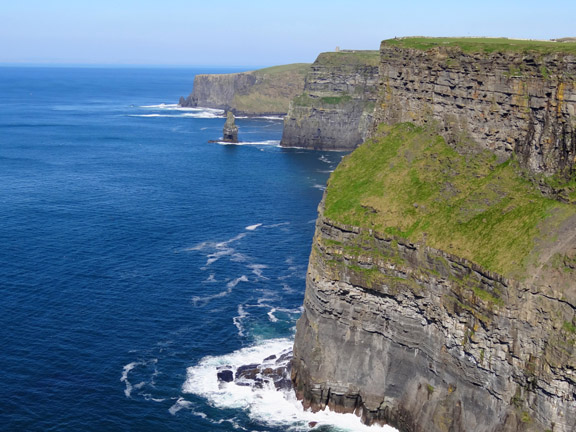
Along the coastline, glacial activity and subsequent sea-level changes have resulted in the formation of sea cliffs, coastal caves, and marine terraces. The Cliffs of Moher in County Clare and the sea stacks of County Antrim exemplify the erosional effects of waves and coastal processes on Ireland’s geology.

[Source: ChatGPT]